
Major differences between Jacksonville’s Westside and Jacksonville’s Beaches
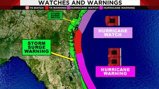

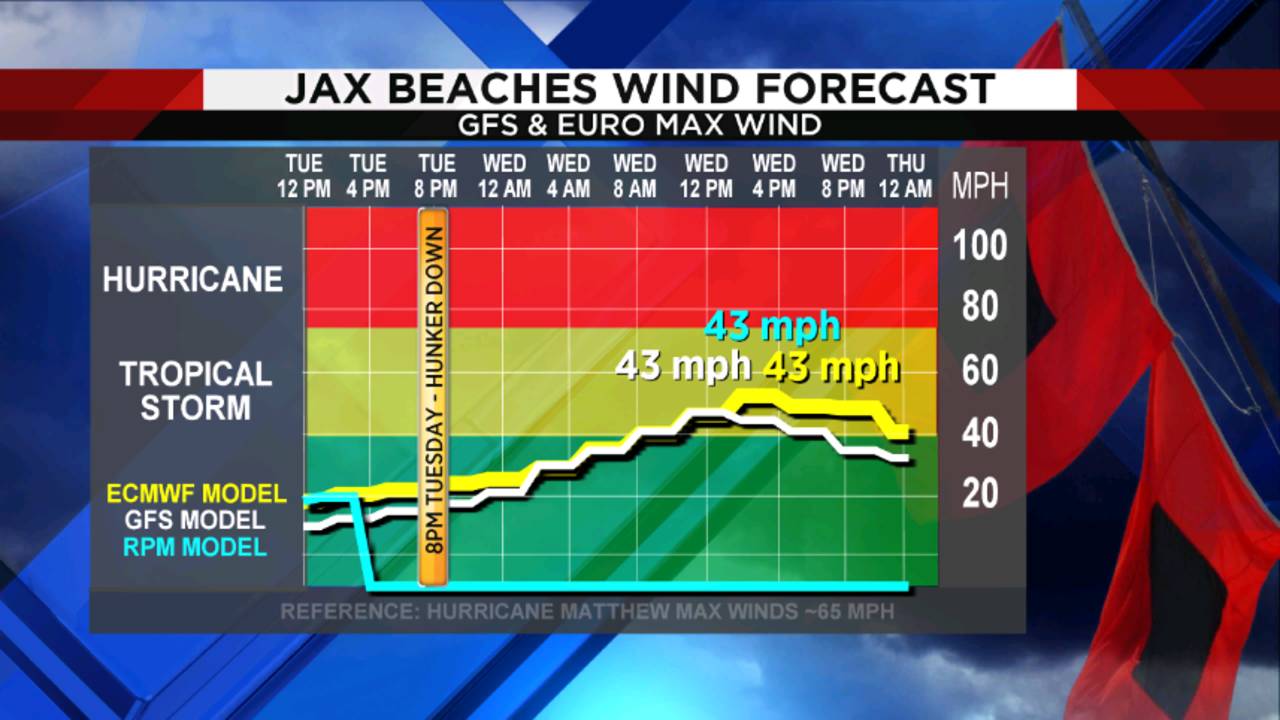
JACKSONVILLE, Fla. – The National Hurricane Center shifted their track slightly to the east on Monday evening/Tuesday morning, with the latest track will still keeps tropical storm force wind conditions (a little less than that of Matthew) along area beaches.
The Triple Threat
Surge, a storm surge of much higher than normal sea levels. I am actually most concerned about these possibly matching or exceeding what we saw with Matthew (2016).
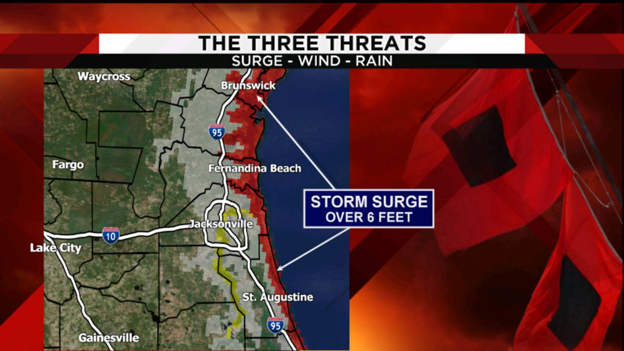
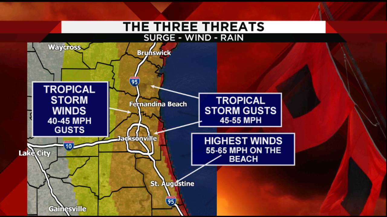
Winds, with the shift to the east in the official NHC track, winds will be less impacting and cause fewer power outages around the area.
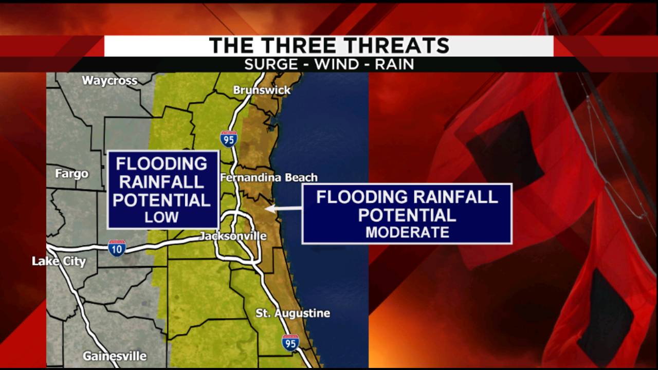
Rainfall, just enough to make some big puddles and some minor flooding during the heaviest of downpours.
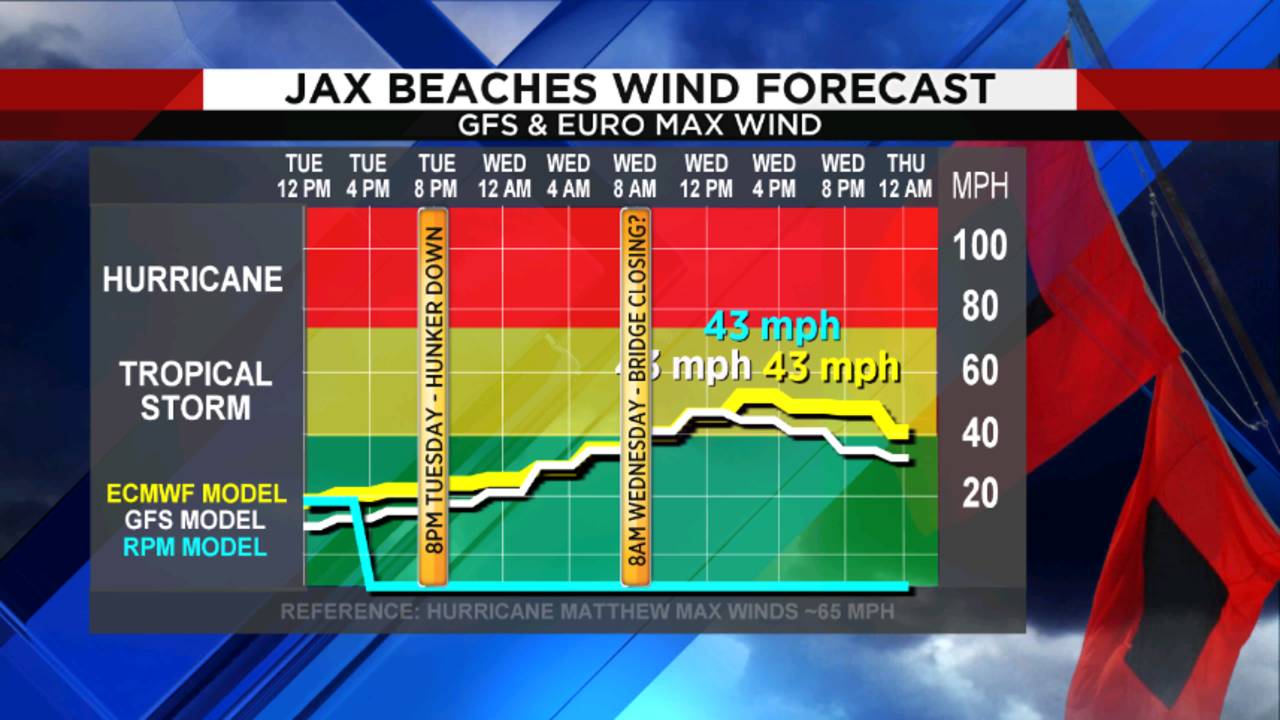
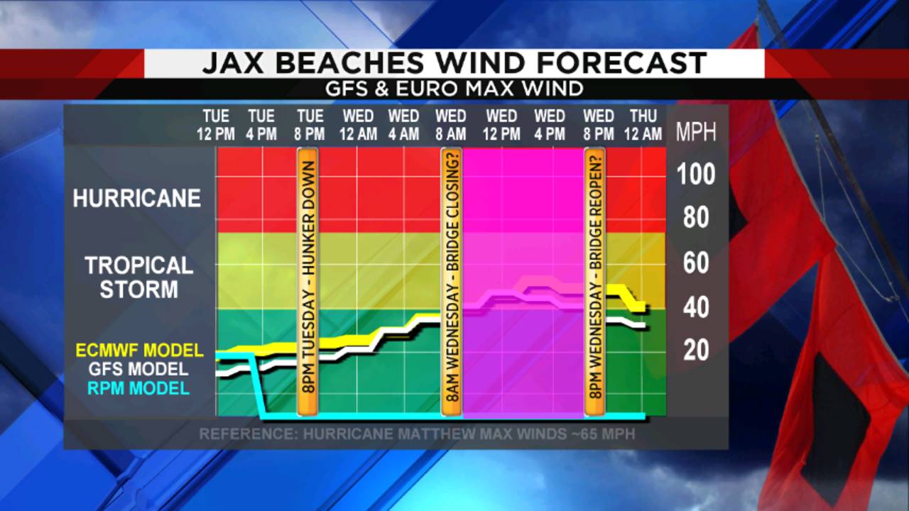
Then there is the timeline of when things get rough.
Hurricane Dorian, a category 4 storm, continued to crawl across the Northern Bahamas on Monday. This will allow Dorian to move along Florida’s coast Tuesday and Wednesday.
Local weather for Tuesday remains relatively calm with a few showers expected. Winds begin to pick up for coastal counties late Tuesday. The first impacts of Dorian will be noticed in Flagler and St. Johns counties starting between 8 p.m. Tuesday and midnight Wednesday. The western edge of Dorian will move north pushing its outer bands in our southernmost zones. Rain will begin to become steady along with increasing wind gusts.

The worst of the weather for Flagler and St. Johns will arrive between 6 a.m. and 2 p.m Wednesday. Strong northeast winds will increase the storm surge the most for coasting cities during this time. We can expect to see rainfall amounts of 4 to 6 inches with sustained winds at 35 to 50 mph and higher gusts of 75 mph. The strength of the winds will decrease farther inland and away from the storm’s center. This means Putnam County will likely have sustained winds at 30 to 35 mph and gusts of 45 mph. Rainfall totals for more inland areas around the St. Johns River will be closer to 2 to 3 inches.

Duval, Nassau, Clay and counties east of the St. Johns River along with Camden and Glynn counties in Southeast Georgia will notice winds intensifying with heavier rainfall amounts between 10 a.m. and 6 p.m. Wednesday. The top edge of the storm approaches, creating strong northeasterly winds, which will help to push water onshore for several hours. Sustained winds will be closer to tropical storm force winds during this time between 30 to 40 mph. Wind gusts will be at its highest averaging 55 mph along the coast and rainfall amounts of 2 to 5 inches. Locations west of the St. Johns River will have less wind with gusts closer to 35 mph and rainfall between 1 to 2 inches.
The center of Hurricane Dorian is expected to be directly off the coast of Duval County, but farther away compared to its pass of St. Johns, which means still tropical force winds and rain but not as widespread. The storm will also be weakening as it moves north.We can expect to feel gusty winds and intense but brief downpours through 5 p.m. on Wednesday with gradual weather improvements in St. Johns and Flagler as a northwest wind begins to help push ocean waters back out. As Dorian picks up speed heading northward, the wind and rain will quickly subside Wednesday night and skies clearing on Thursday.


You must be logged in to post a comment.